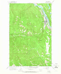
1963 Map of Troy
USGS Topo · Published 1966About this map
The town of Troy serves as the focal point for this 1963 survey of the northern Idaho-Montana borderlands, situated where the Great Northern railroad follows the curve of the Kootenai River. The map documents a rugged landscape defined by intensive mining activity within the Kootenai National Forest, with dozens of named operations scattered across the high terrain of Grouse Mountain and McConnell Mountain.
Find a feature on this map
39 named features on this map. Tap any name to fly to it.
Don’t see what you’re looking for? This feature index may not catch every label — zoom into the map to look around manually.
Map Details
Editions of this 1963 Troy Map
This is the sole edition of this map. No revisions or reprints were ever made.
Other maps of this area

1911 · Priest Lake
USGS Topo · 1:250,000

1913 · Priest Lake
USGS Topo · 1:250,000

1920 · Libby
USGS Topo · 1:125,000

1930 · Libby
USGS Topo · 1:125,000

1932 · Libby
USGS Topo · 1:125,000

1951 · Mt Pend Oreille
USGS Topo · 1:62,500

1957 · Kalispell
USGS Topo · 1:250,000

1958 · Sandpoint
USGS Topo · 1:250,000

1960 · Kalispell
USGS Topo · 1:250,000

1961 · Kalispell
USGS Topo · 1:250,000