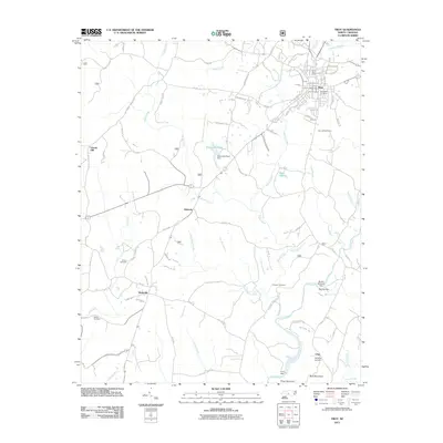
2011 Map of Troy
USGS Topo · Published 2011About this map
The town of Troy serves as the focal point of this Montgomery County landscape, where the Troy Post Office and Southside Cemetery anchor the local community. The topography is defined by a series of south-flowing drainages, including Warner Creek, Rocky Creek, and Little River, which are punctuated by local engineering features like the Alexander Pond Dam and Bruton Millpond Dam. Smaller settlements such as Roberdo, Wadeville, and Chip are connected by a network of rural routes like Hallyburton Rd and Pleasant Grove Church Rd. This survey documents a transition from the structured street grid of the county seat to the outlying hills of Piney Mountain and Buck Mountain. For genealogists, the map preserves the locations of several burial grounds, including the Chisolm and Haywood sites, alongside landmarks like the Troy Lookout Tower.
Find a feature on this map
104 named features on this map. Tap any name to fly to it.
Don’t see what you’re looking for? This feature index may not catch every label — zoom into the map to look around manually.
Map Details
Editions of this 2011 Troy Map
This is the sole edition of this map. No revisions or reprints were ever made.
Other maps of this area

1942 · Troy
USGS Topo · 1:125,000

1953 · Raleigh
USGS Topo · 1:250,000

1953 · Charlotte
USGS Topo · 1:250,000

1954 · Charlotte
USGS Topo · 1:250,000

1954 · Raleigh
USGS Topo · 1:250,000

1956 · Mount Gilead East
USGS Topo · 1:24,000

1956 · Harrisville
USGS Topo · 1:24,000

1956 · Mount Gilead West
USGS Topo · 1:24,000

1957 · Albemarle
USGS Topo · 1:62,500

1957 · Troy
USGS Topo · 1:62,500