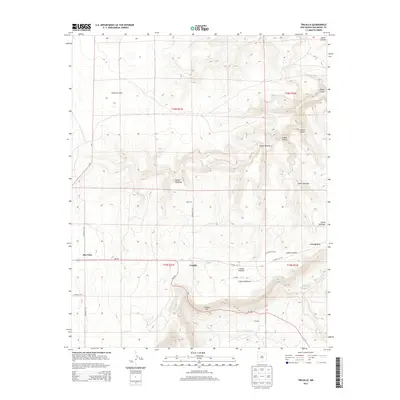
2013 Map of Trujillo
USGS Topo · Published 2013About this map
Trujillo serves as a focal point for this high-plains landscape in San Miguel County, where the terrain is deeply incised by a network of seasonal drainages and mesas. This survey details the complex system of local roads, such as Co Road C-51-A and NM-104, which navigate the land's difficult verticality. The geography is defined by a series of named canyons that dominate the eastern and northern portions of the quadrangle, including Cañon Escovas, Cañon Ventanas, and Cañon Santiago.
Find a feature on this map
27 named features on this map. Tap any name to fly to it.
Don’t see what you’re looking for? This feature index may not catch every label — zoom into the map to look around manually.
Map Details
Editions of this 2013 Trujillo Map
This is the sole edition of this map. No revisions or reprints were ever made.
Other maps of this area

1892 · Watrous
USGS Topo · 1:125,000

1892 · Corazon
USGS Topo · 1:125,000

1894 · Corazon
USGS Topo · 1:125,000

1894 · Watrous
USGS Topo · 1:125,000

1954 · Santa Fe
USGS Topo · 1:250,000

1958 · Santa Fe
USGS Topo · 1:250,000

1963 · Flagstone Mountain
USGS Topo · 1:24,000

1971 · Laguna Huerfana
USGS Topo · 1:24,000
1971 · Canon Pedroso
USGS Topo · 1:24,000

1971 · Trujillo
USGS Topo · 1:24,000