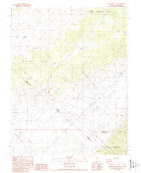
1987 Map of Truman Meadows
USGS Topo · Published 1987About this map
Truman Meadows and the high desert basins of the Queen Valley are defined here by a series of springs and seasonal drainages along the interstate border. This late-twentieth-century survey documents a remote landscape where water sources like Sagehen Spring, McBride Springs, and Truman Spring have long dictated land use across the Toiyabe National Forest and Inyo National Forest. The map captures the historic Von Schmidt Line, the original boundary surveyed between California and Nevada, cutting across the rugged terrain near Benton Valley.
Find a feature on this map
22 named features on this map. Tap any name to fly to it.
Don’t see what you’re looking for? This feature index may not catch every label — zoom into the map to look around manually.
Map Details
Editions of this 1987 Truman Meadows Map
This is the sole edition of this map. No revisions or reprints were ever made.
Other maps of this area

1909 · Hawthorne
USGS Topo · 1:250,000

1911 · Hawthorne
USGS Topo · 1:250,000

1914 · Mt. Morrison
USGS Topo · 1:125,000

1915 · Hawthorne
USGS Topo · 1:250,000

1917 · White Mountain
USGS Topo · 1:125,000

1947 · Mariposa
USGS Topo · 1:250,000

1948 · Walker Lake
USGS Topo · 1:250,000

1948 · Mariposa
USGS Topo · 1:250,000

1957 · Walker Lake
USGS Topo · 1:250,000

1957 · Mariposa
USGS Topo · 1:250,000