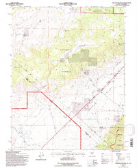
1994 Map of Truman Meadows
USGS Topo · Published 1997About this map
Von Schmidt Line cuts a historic diagonal across this high-altitude landscape, marking the complex borderlands between California and Nevada. This 1994 revision captures the remote intersection of Mineral, Mono, and Esmeralda counties, where the high desert terrain of Queen Valley meets the Boundary Peak Wilderness. The map reveals a land defined by its water sources and mining history, with scattered locations such as McBride Springs, Sagehen Spring, and Orchard Spring providing vital points of reference in an otherwise arid expanse.
Find a feature on this map
25 named features on this map. Tap any name to fly to it.
Don’t see what you’re looking for? This feature index may not catch every label — zoom into the map to look around manually.
Map Details
Editions of this 1994 Truman Meadows Map
This is the sole edition of this map. No revisions or reprints were ever made.
Other maps of this area

1909 · Hawthorne
USGS Topo · 1:250,000

1911 · Hawthorne
USGS Topo · 1:250,000

1914 · Mt. Morrison
USGS Topo · 1:125,000

1915 · Hawthorne
USGS Topo · 1:250,000

1917 · White Mountain
USGS Topo · 1:125,000

1947 · Mariposa
USGS Topo · 1:250,000

1948 · Walker Lake
USGS Topo · 1:250,000

1948 · Mariposa
USGS Topo · 1:250,000

1957 · Walker Lake
USGS Topo · 1:250,000

1957 · Mariposa
USGS Topo · 1:250,000