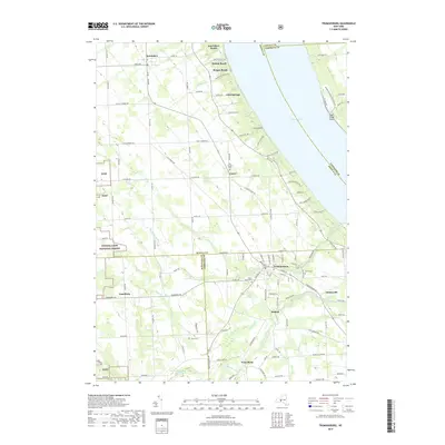
2019 Map of Trumansburg
USGS Topo · Published 2019About this map
Trumansburg serves as a primary hub in this Finger Lakes landscape, where the terrain slopes steadily toward the deep waters of Cayuga Lake. The village and surrounding rural hamlets like Waterburg and Halseyville are defined by a network of creeks, including Taughannock Creek and Trumansburg Cr, that carve deep into the glacial till. To the west, the eastern edge of the Finger Lakes National Forest provides a sharp contrast to the established agricultural plots and shoreline residential developments at Interlaken Beach and Holton Beach. Genealogists will find significant value in the distribution of family and community burial grounds, such as Old Covert Cem near Covert and the Jones Cem located south of Searsburg, documenting generations of settlement in this fertile agricultural belt.
Find a feature on this map
125 named features on this map. Tap any name to fly to it.
Don’t see what you’re looking for? This feature index may not catch every label — zoom into the map to look around manually.
Map Details
Editions of this 2019 Trumansburg Map
This is the sole edition of this map. No revisions or reprints were ever made.
Other maps of this area

1893 · Ithaca
USGS Topo · 1:62,500

1895 · Ithaca
USGS Topo · 1:62,500

1898 · Watkins Glen
USGS Topo · 1:62,500

1901 · Watkins
USGS Topo · 1:62,500

1902 · Genoa
USGS Topo · 1:62,500

1902 · Ovid
USGS Topo · 1:62,500

1905 · Watkins Glen
USGS Topo · 1:125,000

1942 · Ovid
USGS Topo · 1:31,680

1942 · Ludlowville
USGS Topo · 1:24,000

1942 · Lodi
USGS Topo · 1:24,000