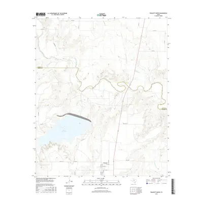
2016 Map of Truscott North
USGS Topo · Published 2016About this map
Truscott Brine Lake dominates the central landscape of this North Texas terrain, positioned along the border between Foard and Knox Counties. This specialized reservoir is part of a larger chloride control project designed to manage the salinity of the North Wichita River basin. The hydrology of the area is defined by numerous drainage systems, including Salt Flat Cr and Buffalo Cr, which carve through the plains toward the main river channel.
Find a feature on this map
34 named features on this map. Tap any name to fly to it.
Don’t see what you’re looking for? This feature index may not catch every label — zoom into the map to look around manually.
Map Details
Editions of this 2016 Truscott North Map
This is the sole edition of this map. No revisions or reprints were ever made.
Other maps of this area

1954 · Wichita Falls
USGS Topo · 1:250,000

1958 · Wichita Falls
USGS Topo · 1:250,000

1966 · Truscott North
USGS Topo · 1:24,000

1966 · Truscott South
USGS Topo · 1:24,000

1966 · Halsell Ranch
USGS Topo · 1:24,000

1966 · Gilliland
USGS Topo · 1:24,000

1966 · Big Four Ranch
USGS Topo · 1:24,000

1966 · Crowell
USGS Topo · 1:24,000

1966 · Maverick Flat
USGS Topo · 1:24,000
1968 · Boiling Spring
USGS Topo · 1:24,000