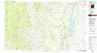
1979 Map of Truth or Consequences
USGS Topo · Published 1979About this map
Truth or Consequences serves as the focal point of this late 1970s Sierra County landscape, situated along the Rio Grande between the Elephant Butte Reservoir and Caballo Reservoir. The map reveals a transition from the engineered water management of the river valley to the mineral-rich heights of the Black Range. To the west, the mining history of the region is evident near the Continental Divide with operations such as the Midnight Mine and Yellowjacket Mine located near the settlements of Winston and Chloride. The eastern portion of the map is dominated by the Jornada Del Muerto and the Fra Cristobal Range, where the Atchison Topeka and Santa Fe railroad cuts a straight path through the desert. This survey documents the area just before the turn of the decade, capturing the spatial relationship between historic mining outposts like Hermosa and the growing recreational infrastructure of Elephant Butte Lake State Park.
Find a feature on this map
70 named features on this map. Tap any name to fly to it.
Don’t see what you’re looking for? This feature index may not catch every label — zoom into the map to look around manually.
Map Details
Editions of this 1979 Truth or Consequences Map
2 editions found

Other maps of this area

1909 · Silver City
USGS Topo · 1:125,000

1911 · Alum Mountain
USGS Topo · 1:125,000

1913 · Alum Mountain
USGS Topo · 1:125,000

1916 · Tonuco
USGS Topo · 1:125,000

1916 · Salinas Peak
USGS Topo · 1:125,000

1918 · Pelona
USGS Topo · 1:125,000

1932 · Tonuco
USGS Topo · 1:125,000

1935 · Hillsboro
USGS Topo · 1:48,000

1940 · Hillsboro
USGS Topo · 1:62,500

1947 · Allie Canyon
USGS Topo · 1:24,000