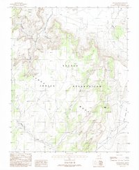
1988 Map of Tseyi-Hatsosi
USGS Topo · Published 1988About this map
Azansosi Mesa and the expansive Tyende Mesa dominate this portion of the Navajo Indian Reservation as it was surveyed in the mid-1980s. The landscape is defined by a complex network of seasonal drainages, including the prominent Olijeto Wash and Cutfoot Wash, which carve through the high plateaus. The topography is further marked by isolated landmarks such as Segoke Butte, overlooking the Little Capitan Valley.
Find a feature on this map
12 named features on this map. Tap any name to fly to it.
Don’t see what you’re looking for? This feature index may not catch every label — zoom into the map to look around manually.
Map Details
Editions of this 1988 Tseyi-Hatsosi Map
This is the sole edition of this map. No revisions or reprints were ever made.
Other maps of this area

1883 · Marsh Pass
USGS Topo · 1:250,000

1892 · Marsh Pass
USGS Topo · 1:250,000

1952 · Agathla Peak 1 NW
USGS Topo · 1:24,000

1952 · Agathla Peak 2 SW
USGS Topo · 1:24,000

1952 · Agathla Peak 2 NW
USGS Topo · 1:24,000

1952 · Boot Mesa
USGS Topo · 1:62,500

1952 · Agathla Peak 2 SE
USGS Topo · 1:24,000

1952 · Agathla Peak 2 NE
USGS Topo · 1:24,000

1952 · Agathla Peak
USGS Topo · 1:62,500

1952 · Agathla Peak 1 SW
USGS Topo · 1:24,000