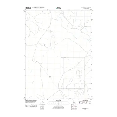
2010 Map of Tuanna Butte
USGS Topo · Published 2010About this map
Salmon Falls Creek and Devil Creek carve paths through this landscape, meeting near the historic Tuanna Crossing. The terrain is defined by volcanic features, most notably Tuanna Butte in the southern portion and Devil Creek Butte to the west. This 2010 survey reflects a high-desert environment where water management is critical for agriculture, evidenced by the reach of the High Line Canal in the northeast. The map illustrates a sparse but organized road network, including the diagonal Tuanna Rd and various sectional roads like E 3400 N and N 700 E that serve the local rural tracts. For those researching the history of Twin Falls County, this record documents the intersection of natural watercourses and the infrastructure built to navigate and utilize them.
Find a feature on this map
20 named features on this map. Tap any name to fly to it.
Don’t see what you’re looking for? This feature index may not catch every label — zoom into the map to look around manually.
Map Details
Editions of this 2010 Tuanna Butte Map
This is the sole edition of this map. No revisions or reprints were ever made.
Other maps of this area

1955 · Twin Falls
USGS Topo · 1:250,000

1958 · Twin Falls
USGS Topo · 1:250,000

1958 · Buhl
USGS Topo · 1:24,000

1959 · Buhl
USGS Topo · 1:62,500

1959 · Crows Nest
USGS Topo · 1:62,500

1964 · Roseworth
USGS Topo · 1:24,000

1965 · Roseworth SE
USGS Topo · 1:24,000

1965 · Roseworth NE
USGS Topo · 1:24,000

1965 · Tuanna Butte
USGS Topo · 1:24,000

1979 · Coonskin Butte NE
USGS Topo · 1:24,000