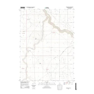
2013 Map of Tuanna Butte
USGS Topo · Published 2013About this map
Tuanna Crossing sits at the heart of this high desert landscape, marking a historical point of passage in an area defined by dramatic geological transitions. The terrain shifts from the open expanse of the Bruneau Desert in the west to the deeply incised canyon of Salmon Falls Cr in the northeast. This 2013 survey illustrates the critical role of water management in the arid West, showing the High Line Canal skirting the canyon rim to provide irrigation. Local landmarks like Tuanna Butte and Devil Creek Butte rise above the surrounding plateaus, while drainage systems such as Devil Cr and Blue Gulch reveal the natural erosion patterns of the volcanic soil. The map also traces the modern road network, including Lily Grade Rd and House Creek Rd, which provide access to these remote Idaho rangelands.
Find a feature on this map
23 named features on this map. Tap any name to fly to it.
Don’t see what you’re looking for? This feature index may not catch every label — zoom into the map to look around manually.
Map Details
Editions of this 2013 Tuanna Butte Map
This is the sole edition of this map. No revisions or reprints were ever made.
Other maps of this area

1955 · Twin Falls
USGS Topo · 1:250,000

1958 · Twin Falls
USGS Topo · 1:250,000

1958 · Buhl
USGS Topo · 1:24,000

1959 · Buhl
USGS Topo · 1:62,500

1959 · Crows Nest
USGS Topo · 1:62,500

1964 · Roseworth
USGS Topo · 1:24,000

1965 · Roseworth SE
USGS Topo · 1:24,000

1965 · Roseworth NE
USGS Topo · 1:24,000

1965 · Tuanna Butte
USGS Topo · 1:24,000

1979 · Coonskin Butte NE
USGS Topo · 1:24,000