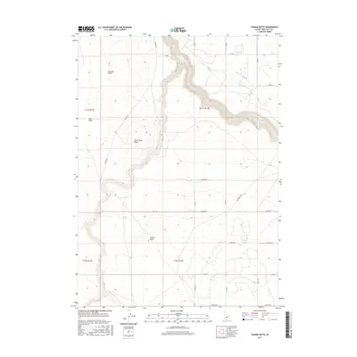
2017 Map of Tuanna Butte
USGS Topo · Published 2017About this map
Bruneau Desert terrain dominates the landscape in this region of Twin Falls County, where the deep incisions of Salmon Falls Cr and Devil Cr cut through the high plains. The topography is defined by prominent volcanic features like Tuanna Butte and Devil Creek Butte, which serve as significant landmarks above the surrounding flats. The human imprint on the land is marked by a rigid grid of rural roads and the vital presence of the High Line Canal, illustrating the managed water systems necessary for activity in this arid environment. Significant elevation changes are visible at Blue Gulch and along the winding Lily Grade Rd, where the road descends toward the canyon floor, providing a detailed look at the interface between the desert floor and the drainage networks of the Snake River Plain.
Find a feature on this map
26 named features on this map. Tap any name to fly to it.
Don’t see what you’re looking for? This feature index may not catch every label — zoom into the map to look around manually.
Map Details
Editions of this 2017 Tuanna Butte Map
This is the sole edition of this map. No revisions or reprints were ever made.
Other maps of this area

1955 · Twin Falls
USGS Topo · 1:250,000

1958 · Twin Falls
USGS Topo · 1:250,000

1958 · Buhl
USGS Topo · 1:24,000

1959 · Buhl
USGS Topo · 1:62,500

1959 · Crows Nest
USGS Topo · 1:62,500

1964 · Roseworth
USGS Topo · 1:24,000

1965 · Roseworth SE
USGS Topo · 1:24,000

1965 · Roseworth NE
USGS Topo · 1:24,000

1965 · Tuanna Butte
USGS Topo · 1:24,000

1979 · Coonskin Butte NE
USGS Topo · 1:24,000