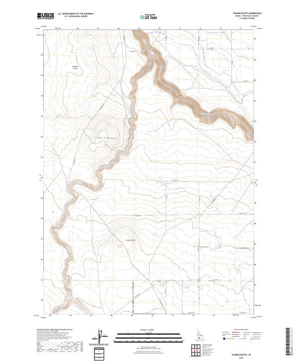
2023 Map of Tuanna Butte
USGS Topo · Published 2023About this map
Tuanna Butte and Devil Creek Butte rise as prominent geological landmarks above a landscape defined by deep canyon incisions and arid plateaus. The Salmon Falls Creek winds through the eastern portion of the quadrangle, joined by the deeply etched drainage of Devil Creek which cuts through the volcanic geology of the region. This 2023 survey illustrates the sparse, high-desert infrastructure of western Twin Falls County, where the rugged Bruneau Desert meets early agricultural irrigation systems like the High Line Canal. The map reveals a network of remote access routes including Lily Grade Rd and Big Bend Rd, reflecting the long-standing use of this terrain for ranching and resource management. The interplay between the natural watercourses and the gridded road system provides a clear view of the area’s modern-day land use patterns.
Find a feature on this map
22 named features on this map. Tap any name to fly to it.
Don’t see what you’re looking for? This feature index may not catch every label — zoom into the map to look around manually.
Map Details
Editions of this 2023 Tuanna Butte Map
This is the sole edition of this map. No revisions or reprints were ever made.
Other maps of this area

1955 · Twin Falls
USGS Topo · 1:250,000

1958 · Twin Falls
USGS Topo · 1:250,000

1958 · Buhl
USGS Topo · 1:24,000

1959 · Buhl
USGS Topo · 1:62,500

1959 · Crows Nest
USGS Topo · 1:62,500

1964 · Roseworth
USGS Topo · 1:24,000

1965 · Roseworth SE
USGS Topo · 1:24,000

1965 · Roseworth NE
USGS Topo · 1:24,000

1965 · Tuanna Butte
USGS Topo · 1:24,000

1979 · Coonskin Butte NE
USGS Topo · 1:24,000