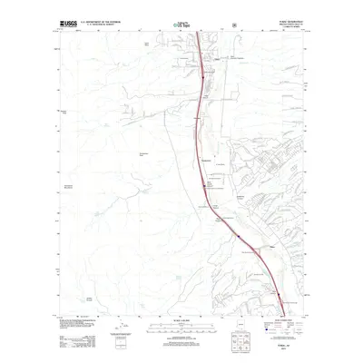
2012 Map of Tubac
USGS Topo · Published 2012About this map
The Santa Cruz River valley serves as the central artery for this part of Southern Arizona, anchoring a string of settlements and historic landholdings. The area around Tubac and Tumacacori is characterized by a mix of traditional ranching properties and more modern developments. Named landmarks such as Kenyon Ranch, San Cayetano Ranch, and Rock Corral Ranch reflect the long-standing agricultural and residential heritage of the region. To the west, the landscape rises sharply into the Tumacacori Mountains, where Tumacacori Peak and Sardina Peak dominate the skyline.
Find a feature on this map
141 named features on this map. Tap any name to fly to it.
Don’t see what you’re looking for? This feature index may not catch every label — zoom into the map to look around manually.
Map Details
Editions of this 2012 Tubac Map
This is the sole edition of this map. No revisions or reprints were ever made.
Other maps of this area

1904 · Patagonia
USGS Topo · 1:125,000

1905 · Patagonia
USGS Topo · 1:125,000

1905 · Nogales
USGS Topo · 1:125,000

1920 · Arivaca
USGS Topo · 1:125,000

1921 · Old Glory
USGS Topo · 1:125,000

1922 · Agus Caliente
USGS Topo · 1:62,500

1933 · Calabasas
USGS Topo · 1:62,500

1939 · Tubac
USGS Topo · 1:62,500

1942 · Ruby
USGS Topo · 1:62,500

1943 · Old Glory
USGS Topo · 1:125,000