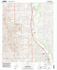
1996 Map of Tubac
USGS Topo · Published 2002About this map
The Santa Cruz River corridor serves as the lifeline for this region of Southern Arizona, anchoring ancient settlements and colonial landmarks against a backdrop of the Coronado National Forest. In the late 20th century, this area maintained a deep connection to its mission-era roots, centered on the Tubac Presidio State Historical Park and the Tumacacori National Monument. The map documents the transition from these high-density cultural sites to the expansive ranching lands of the Luis Maria Baca and Baca Float No 3 grants.
Find a feature on this map
58 named features on this map. Tap any name to fly to it.
Don’t see what you’re looking for? This feature index may not catch every label — zoom into the map to look around manually.
Map Details
Editions of this 1996 Tubac Map
This is the sole edition of this map. No revisions or reprints were ever made.
Other maps of this area

1904 · Patagonia
USGS Topo · 1:125,000

1905 · Patagonia
USGS Topo · 1:125,000

1905 · Nogales
USGS Topo · 1:125,000

1920 · Arivaca
USGS Topo · 1:125,000

1921 · Old Glory
USGS Topo · 1:125,000

1922 · Agus Caliente
USGS Topo · 1:62,500

1933 · Calabasas
USGS Topo · 1:62,500

1939 · Tubac
USGS Topo · 1:62,500

1942 · Ruby
USGS Topo · 1:62,500

1943 · Old Glory
USGS Topo · 1:125,000