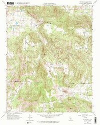
1966 Map of Tucker Mtn
USGS Topo · Published 1967About this map
The high valley floors and foothill ranchlands of the Sierra Nevada foothills are captured here in the mid-1960s, a landscape defined by seasonal drainages and scattered agricultural holdings. Squaw Valley serves as a primary settlement point, anchored by the Squaw Valley Sch and Squaw Valley Cemetery. The map documents a network of family-owned ranching operations, including the Nance Ranch, Baker Ranch, and Harlan Ranch, which follow the contours of Mill Creek and Sand Creek.
Find a feature on this map
35 named features on this map. Tap any name to fly to it.
Don’t see what you’re looking for? This feature index may not catch every label — zoom into the map to look around manually.
Map Details
Editions of this 1966 Tucker Mtn Map
2 editions found
Other maps of this area

1921 · Squaw Valley
USGS Topo · 1:31,680

1921 · Stokes Mountain
USGS Topo · 1:24,000

1922 · Trimmer
USGS Topo · 1:96,000

1923 · Sultana
USGS Topo · 1:31,680

1924 · Citrus Cove
USGS Topo · 1:31,680

1924 · Dinuba
USGS Topo · 1:125,000

1924 · Stokes Mountain
USGS Topo · 1:31,680

1942 · Watts Valley
USGS Topo · 1:62,500

1942 · Dunlap
USGS Topo · 1:62,500

1944 · Watts Valley
USGS Topo · 1:62,500