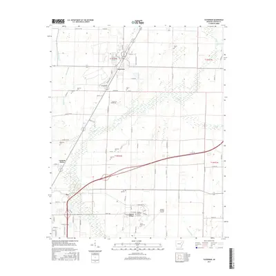
2017 Map of Tuckerman
USGS Topo · Published 2017About this map
Tuckerman anchors this central Jackson County landscape, characterized by a complex network of agricultural drainage and natural waterways that define the regional economy. The layout of the town, featuring streets like Front St and Martin Luther King, reflects a traditional settlement pattern along the transportation corridor. To the southwest, Diaz and the Airport Village community sit near the Newport Municipal Airport, where the Arkansas State Univ Newport campus establishes a prominent institutional footprint. A significant density of burial grounds, including Gracelawn Cem, Stennick Cem, and Greenhaw Cem, suggests a long-established rural population. The terrain is deeply influenced by water management, with Village Creek winding through the center, supplemented by man-made channels like Hatchet Ditch and Pompeys Ditch that facilitate the heavy cultivation visible across the township lines of T13N and T12N.
Find a feature on this map
89 named features on this map. Tap any name to fly to it.
Don’t see what you’re looking for? This feature index may not catch every label — zoom into the map to look around manually.
Map Details
Editions of this 2017 Tuckerman Map
This is the sole edition of this map. No revisions or reprints were ever made.
Other maps of this area

1932 · Strawberry
USGS Topo · 1:62,500

1935 · Alicia
USGS Topo · 1:62,500

1935 · Strawberry
USGS Topo · 1:62,500

1935 · Newport
USGS Topo · 1:62,500

1935 · Tuckerman
USGS Topo · 1:62,500

1941 · Strawberry
USGS Topo · 1:62,500

1953 · Memphis
USGS Topo · 1:250,000

1955 · Cord
USGS Topo · 1:24,000

1956 · Memphis
USGS Topo · 1:250,000

1962 · Jacksonport
USGS Topo · 1:24,000