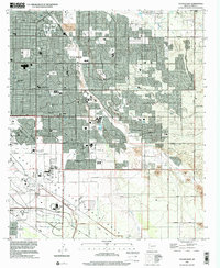
1996 Map of Tucson East
USGS Topo · Published 2002About this map
Davis-Monthan Air Force Base anchor the landscape of southeastern Tucson in the late 1990s, where suburban expansion meets the desert washes of the Santa Cruz Valley. The map captures a high-growth era, showing the transition from dense residential developments like Vandenberg Village and Littleton to the industrial and aeronautical spaces near the Pima Air & Space Museum. Watercourses such as Pantano Wash and Agua Caliente Wash cut through the grid of major thoroughfares like Speedway Blvd and Golf Links Road, defining the natural drainage patterns of the basin. Commercial hubs, including the Park Mall and Oxford Plaza Shopping Center, reflect the mid-to-late century retail boom that transformed this part of Pima County. Farther south, the tracks of the Southern Pacific railroad parallel the edge of the Tucson Corporate Bdy, marking the intersection of regional transportation and urban limits.
Find a feature on this map
43 named features on this map. Tap any name to fly to it.
Don’t see what you’re looking for? This feature index may not catch every label — zoom into the map to look around manually.
Map Details
Editions of this 1996 Tucson East Map
This is the sole edition of this map. No revisions or reprints were ever made.
Other maps of this area

1904 · Tucson
USGS Topo · 1:125,000

1905 · Tucson
USGS Topo · 1:125,000

1948 · Tucson
USGS Topo · 1:62,500

1956 · Tucson
USGS Topo · 1:250,000

1957 · Tucson East
USGS Topo · 1:24,000

1957 · Bellota Ranch
USGS Topo · 1:62,500

1957 · Tucson
USGS Topo · 1:24,000

1957 · Tucson
USGS Topo · 1:62,500

1957 · Rincon Valley
USGS Topo · 1:62,500

1957 · Sabino Canyon
USGS Topo · 1:24,000