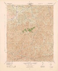
1944 Map of Tujunga
USGS Topo · Published 1944About this map
Southern Pacific tracks wind through the northern canyons of this mid-century survey, passing through the small settlements of Acton and Ravenna within the high desert corridor. This landscape is dominated by the massive peaks of the San Gabriel Mountains, which occupy the majority of the Angeles National Forest. The map documents a critical era of regional infrastructure, showing the Angeles Crest Highway cutting through the southern ridges while the Tujunga Dam manages water flow below Josephine Mt. For researchers of early California mining, the presence of the Monte Cristo Mines along Monte Cristo Creek indicates the industrial activity that persisted in these steep canyons. The map also captures several private landings and family holdings like Hoyt Ranch, set against a backdrop of prominent summits including Strawberry Peak and Mt Lukens.
Find a feature on this map
36 named features on this map. Tap any name to fly to it.
Don’t see what you’re looking for? This feature index may not catch every label — zoom into the map to look around manually.
Map Details
Editions of this 1944 Tujunga Map
This is the sole edition of this map. No revisions or reprints were ever made.
Other maps of this area

1894 · Los Angeles
USGS Topo · 1:62,500

1894 · Pomona
USGS Topo · 1:62,500

1896 · Pasadena
USGS Topo · 1:62,500

1896 · Santa Monica
USGS Topo · 1:62,500

1897 · Pomona
USGS Topo · 1:62,500

1898 · Pomona
USGS Topo · 1:62,500

1898 · Santa Monica
USGS Topo · 1:62,500

1900 · Pasadena
USGS Topo · 1:62,500

1900 · Tujunga
USGS Topo · 1:62,500

1900 · Los Angeles
USGS Topo · 1:62,500