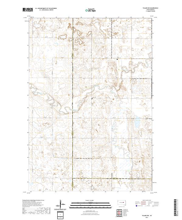
2021 Map of Tulare NW
USGS Topo · Published 2021About this map
Turtle Creek and Wolf Creek meander through this prairie landscape where the borders of Hand, Spink, and Beadle counties converge. The terrain is defined by a dense network of seasonal wetlands and glacial depressions typical of the Missouri Coteau region. This 2021 survey reveals a strictly organized section-line road grid, including State Hwy 28, which anchors the southern reaches of the quadrangle. Local history is anchored by the presence of Saint John's Cem and Buffalo Cem, which serve as quiet landmarks among the expansive agricultural fields. The map provides a clear look at the hydraulic patterns of the creeks and their various branches, such as Turtle Cr, illustrating how water moves across this high plains environment.
Find a feature on this map
33 named features on this map. Tap any name to fly to it.
Don’t see what you’re looking for? This feature index may not catch every label — zoom into the map to look around manually.
Map Details
Editions of this 2021 Tulare NW Map
This is the sole edition of this map. No revisions or reprints were ever made.
Other maps of this area

1899 · Redfield
USGS Topo · 1:125,000

1953 · Huron
USGS Topo · 1:250,000

1954 · Huron
USGS Topo · 1:250,000

1966 · Burdette
USGS Topo · 1:24,000

1966 · Redfield South
USGS Topo · 1:24,000
1966 · Rockham SE
USGS Topo · 1:24,000

1966 · Redfield SW
USGS Topo · 1:24,000

1967 · Tulare NW
USGS Topo · 1:24,000

1967 · Tulare SE
USGS Topo · 1:24,000
1967 · Miller SE
USGS Topo · 1:24,000