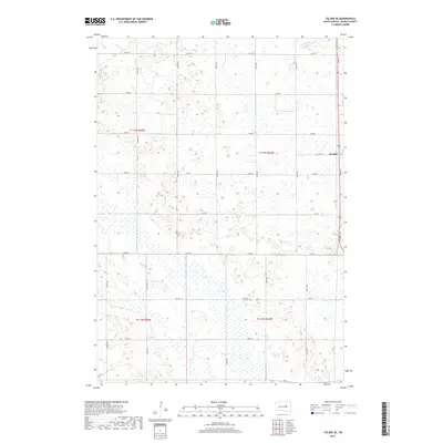
2017 Map of Tulare SE
USGS Topo · Published 2017About this map
Bonilla occupies the northeastern corner of this Beadle County landscape, situated along the north-south corridor of the highway and marking the primary point of settlement. The surrounding terrain is defined by an intricate network of wetlands and seasonal basins characteristic of the James River Valley, notably Fox Lake and the meandering path of Cain Cr. This 2017 survey reveals a highly organized township-and-range grid, where section lines are traced by local thoroughfares like Co Rd 8 and an array of numbered avenues. The geography here is a classic example of the prairie pothole region, where small depressions create a complex drainage pattern that has dictated road placement and land use for generations. While the town of Bonilla remains the focal point, the map's fine contour lines show a subtle, undulating topography that continues to shape the agricultural and hydrological character of the county.
Find a feature on this map
24 named features on this map. Tap any name to fly to it.
Don’t see what you’re looking for? This feature index may not catch every label — zoom into the map to look around manually.
Map Details
Editions of this 2017 Tulare SE Map
This is the sole edition of this map. No revisions or reprints were ever made.
Other maps of this area

1895 · Byron
USGS Topo · 1:125,000

1898 · Huron
USGS Topo · 1:125,000

1899 · Redfield
USGS Topo · 1:125,000

1950 · Wessington
USGS Topo · 1:24,000

1950 · Wessington NE
USGS Topo · 1:24,000

1953 · Huron
USGS Topo · 1:250,000

1954 · Huron
USGS Topo · 1:250,000

1967 · Hitchcock SW
USGS Topo · 1:24,000

1967 · Tulare NW
USGS Topo · 1:24,000

1967 · Tulare SE
USGS Topo · 1:24,000