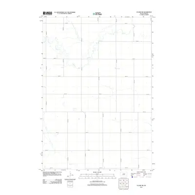
2012 Map of Tulare SW
USGS Topo · Published 2012About this map
Turtle Cr meanders across the northern portion of this Beadle County landscape, carving a winding path through the characteristic section-line grid of rural South Dakota. The drainage patterns of the region are defined by this creek and the southern reaches of Pearl Cr, which together dictate the topography amidst a strictly ordered network of agricultural roads. This survey, reflecting the area in 2012, shows the transition from the high-numbered northern roads like 191st St down to 199th St at the southern boundary.
Find a feature on this map
18 named features on this map. Tap any name to fly to it.
Don’t see what you’re looking for? This feature index may not catch every label — zoom into the map to look around manually.
Map Details
Editions of this 2012 Tulare SW Map
This is the sole edition of this map. No revisions or reprints were ever made.
Other maps of this area

1899 · Redfield
USGS Topo · 1:125,000

1950 · Vayland
USGS Topo · 1:24,000

1950 · Wessington
USGS Topo · 1:24,000

1950 · Wessington NE
USGS Topo · 1:24,000

1953 · Huron
USGS Topo · 1:250,000

1954 · Huron
USGS Topo · 1:250,000

1966 · Burdette
USGS Topo · 1:24,000

1967 · Tulare NW
USGS Topo · 1:24,000

1967 · Tulare SE
USGS Topo · 1:24,000
1967 · Miller SE
USGS Topo · 1:24,000