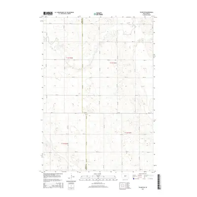
2015 Map of Tulare SW
USGS Topo · Published 2015About this map
The county line between Hand Co and Beadle Co defines the central axis of this landscape on the eastern Dakota plains. The terrain is characterized by the winding path of Turtle Cr in the north and the headwaters of Pearl Cr in the south, both cutting through a glaciated prairie marked by numerous small depressions and potholes. This 2015 survey shows a strictly organized section-line road network, where routes like 191st St and 374th Ave create a consistent grid across the agricultural landscape. The map provides a precise view of the rural drainage patterns and land divisions within the townships of T113n R66w and T112n R65w, reflecting the enduring structure of the Public Land Survey System in South Dakota.
Find a feature on this map
23 named features on this map. Tap any name to fly to it.
Don’t see what you’re looking for? This feature index may not catch every label — zoom into the map to look around manually.
Map Details
Editions of this 2015 Tulare SW Map
This is the sole edition of this map. No revisions or reprints were ever made.
Other maps of this area

1899 · Redfield
USGS Topo · 1:125,000

1950 · Vayland
USGS Topo · 1:24,000

1950 · Wessington
USGS Topo · 1:24,000

1950 · Wessington NE
USGS Topo · 1:24,000

1953 · Huron
USGS Topo · 1:250,000

1954 · Huron
USGS Topo · 1:250,000

1966 · Burdette
USGS Topo · 1:24,000

1967 · Tulare NW
USGS Topo · 1:24,000

1967 · Tulare SE
USGS Topo · 1:24,000
1967 · Miller SE
USGS Topo · 1:24,000