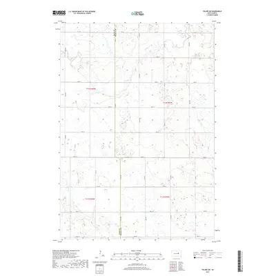
2017 Map of Tulare SW
USGS Topo · Published 2017About this map
The border of Hand Co and Beadle Co defines the central axis of this prairie landscape in east-central South Dakota. This region is characterized by an extensive network of wetlands and intermittent watercourses, most notably Turtle Creek which meanders across the northern half of the sheet. In the southern reaches, Pearl Creek cuts through the terrain, illustrating the natural drainage patterns of the Glacial Lake Agassiz plain.
Find a feature on this map
25 named features on this map. Tap any name to fly to it.
Don’t see what you’re looking for? This feature index may not catch every label — zoom into the map to look around manually.
Map Details
Editions of this 2017 Tulare SW Map
This is the sole edition of this map. No revisions or reprints were ever made.
Other maps of this area

1899 · Redfield
USGS Topo · 1:125,000

1950 · Vayland
USGS Topo · 1:24,000

1950 · Wessington
USGS Topo · 1:24,000

1950 · Wessington NE
USGS Topo · 1:24,000

1953 · Huron
USGS Topo · 1:250,000

1954 · Huron
USGS Topo · 1:250,000

1966 · Burdette
USGS Topo · 1:24,000

1967 · Tulare NW
USGS Topo · 1:24,000

1967 · Tulare SE
USGS Topo · 1:24,000
1967 · Miller SE
USGS Topo · 1:24,000