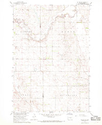
1967 Map of Tulare SW
USGS Topo · Published 1968About this map
Turtle Creek winds across the northern landscape of this prairie region, defining the transition between the townships of Gilbert and Vance. This mid-century survey by the U. S. Bureau of Reclamation and USGS captures the rural infrastructure along the Hand Co Beadle Co line just before the late 1960s. The settlement pattern is sparse, centered on community gathering points such as the Tipton Community Ch and local Townhall sites. In the southern portion of the map, Pearl Creek meanders through the areas of Grand and Whiteside, where several Gravel Pits indicate the local extraction industry supporting the section-line road network. The map is particularly detailed in its depiction of land management, featuring fine dashed lines that represent fence and field boundaries visible from 1965 aerial photography.
Find a feature on this map
11 named features on this map. Tap any name to fly to it.
Don’t see what you’re looking for? This feature index may not catch every label — zoom into the map to look around manually.
Map Details
Editions of this 1967 Tulare SW Map
This is the sole edition of this map. No revisions or reprints were ever made.
Other maps of this area

1899 · Redfield
USGS Topo · 1:125,000

1950 · Vayland
USGS Topo · 1:24,000

1950 · Wessington
USGS Topo · 1:24,000

1950 · Wessington NE
USGS Topo · 1:24,000

1953 · Huron
USGS Topo · 1:250,000

1954 · Huron
USGS Topo · 1:250,000

1966 · Burdette
USGS Topo · 1:24,000

1967 · Tulare NW
USGS Topo · 1:24,000

1967 · Tulare SE
USGS Topo · 1:24,000
1967 · Miller SE
USGS Topo · 1:24,000