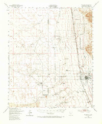
1948 Map of Tularosa
USGS Topo · Published 1967About this map
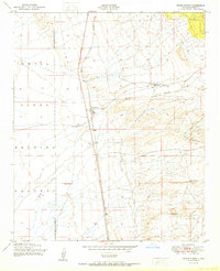
Tularosa serves as the primary hub of this high-desert landscape, situated where the Tularosa River emerges from the eastern mountains toward the sprawling basin floor. In the late 1940s, this region was undergoing a profound shift as traditional ranching life at places like Stover Ranch and Purday Ranch met the expanding footprint of the Cold War. Large swaths of the terrain are dedicated to the White Sands Proving Ground and the Alamogordo Bombing Range, with a notable scientific presence marked by the California Institute of Technology. The Southern Pacific railroad runs parallel to the highway, connecting the town to the broader world. Water remains the critical driver of settlement, evidenced by the numerous named wells and springs like Lomitas Spring and Berral Well that dot the arid flats near The Sands.
Find a feature on this map
44 named features on this map. Tap any name to fly to it.
Don’t see what you’re looking for? This feature index may not catch every label — zoom into the map to look around manually.
Map Details
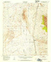
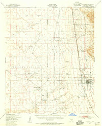
Editions of this 1948 Tularosa Map
2 editions found
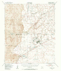
Other maps of this area

1916 · Tularosa
USGS Topo · 1:125,000

1916 · Point Of Sands
USGS Topo · 1:125,000

1947 · Point Of Sands 2
USGS Topo · 1:62,500
1947 · Three Rivers
USGS Topo · 1:62,500

1947 · Capitol Peak
USGS Topo · 1:62,500

1948 · Lumley Lake
USGS Topo · 1:62,500
1948 · Tularosa
USGS Topo · 1:62,500
1948 · Holloman
USGS Topo · 1:62,500
1950 · Three Rivers
USGS Topo · 1:24,000
1950 · Alamogordo
USGS Topo · 1:62,500