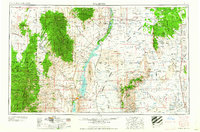
1958 Map of Tularosa
USGS Topo · Published 1958About this map
Elephant Butte Reservoir and the Rio Grande corridor anchor this mid-century landscape, a region defined by its complex mix of federal land management and small-scale settlement. The presence of the Atchison Topeka and Santa Fe Railway running through San Antonio and the San Marcial (ruins) illustrates the shifting fortunes of rail-side towns along the river. In the east, the Jornada del Muerto plain gives way to the massive restricted zones of the Alamogordo Bombing Range and the White Sands Proving Ground, signaling the era's significant military footprint.
Find a feature on this map
45 named features on this map. Tap any name to fly to it.
Don’t see what you’re looking for? This feature index may not catch every label — zoom into the map to look around manually.
Map Details
Editions of this 1958 Tularosa Map
2 editions found

Other maps of this area

1906 · Socorro
USGS Topo · 1:62,500

1909 · Silver City
USGS Topo · 1:125,000

1911 · Alum Mountain
USGS Topo · 1:125,000

1913 · Alum Mountain
USGS Topo · 1:125,000

1916 · La Joya
USGS Topo · 1:125,000

1916 · Tonuco
USGS Topo · 1:125,000

1916 · Salinas Peak
USGS Topo · 1:125,000

1916 · Tularosa
USGS Topo · 1:125,000

1916 · Point Of Sands
USGS Topo · 1:125,000

1918 · Pelona
USGS Topo · 1:125,000