
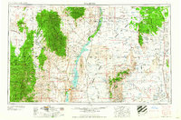
1958 Map of Tularosa
USGS Topo · Published 1958About this map
The Rio Grande corridor anchors this mid-century survey, flowing through the heart of Southern New Mexico into the sprawling Elephant Butte Reservoir. The landscape is dominated by the vast, arid expanse of the Jornada Del Muerto and the sharp rises of the San Mateo Mountains and the Black Range. This era captures the transition of the region into a major military and scientific hub, with the White Sands Proving Ground and the Alamogordo Bombing Range occupying significant portions of the high desert.
Find a feature on this map
66 named features on this map. Tap any name to fly to it.
Don’t see what you’re looking for? This feature index may not catch every label — zoom into the map to look around manually.
Map Details
Editions of this 1958 Tularosa Map
2 editions found
Other maps of this area

1906 · Socorro
USGS Topo · 1:62,500

1909 · Silver City
USGS Topo · 1:125,000

1911 · Alum Mountain
USGS Topo · 1:125,000

1913 · Alum Mountain
USGS Topo · 1:125,000

1916 · La Joya
USGS Topo · 1:125,000

1916 · Tonuco
USGS Topo · 1:125,000

1916 · Salinas Peak
USGS Topo · 1:125,000

1916 · Tularosa
USGS Topo · 1:125,000

1916 · Point Of Sands
USGS Topo · 1:125,000

1918 · Pelona
USGS Topo · 1:125,000