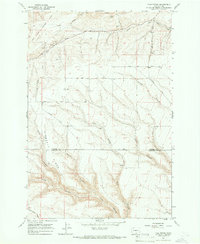
1965 Map of Tule Prong
USGS Topo · Published 1966About this map
The Yakima Indian Reservation Boundary and the Old Indian Treaty Boundary intersect the high plateau country of south-central Washington on this mid-1960s survey. The landscape is defined by deep incisions like Stone Canyon and Tule Canyon, where seasonal drainage systems like Tule Prong flow toward the Columbia River basin. This survey documents the rural infrastructure of the era, including the Dorothy Sch and Glade Cem near Glade Creek. The road network consists primarily of named gravel and dirt routes such as Smith Road and Johnson Road, tracing the flat tops of ridges like Jerry Kimbrell Ridge before descending into the dramatic canyon topography. Evidence of local agriculture is seen at the Storage Bins located near the headwaters of the prong.
Find a feature on this map
24 named features on this map. Tap any name to fly to it.
Don’t see what you’re looking for? This feature index may not catch every label — zoom into the map to look around manually.
Map Details
Editions of this 1965 Tule Prong Map
This is the sole edition of this map. No revisions or reprints were ever made.
Other maps of this area

1906 · Blalock Island
USGS Topo · 1:125,000

1908 · Blalock Island
USGS Topo · 1:125,000

1910 · Zillah
USGS Topo · 1:125,000

1915 · Prosser
USGS Topo · 1:125,000

1916 · Arlington
USGS Topo · 1:125,000

1917 · Prosser
USGS Topo · 1:125,000

1950 · Yakima
USGS Topo · 1:250,000

1953 · Pendleton
USGS Topo · 1:250,000

1953 · Walla Walla
USGS Topo · 1:250,000

1953 · The Dalles
USGS Topo · 1:250,000