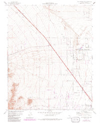
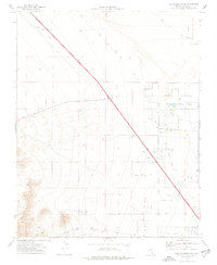
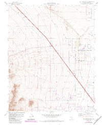
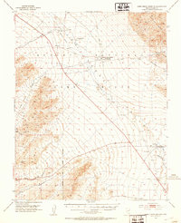
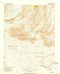
1974 Map of Tule Springs Park
USGS Topo · Published 1991About this map
Floyd R Lamb State Park anchors the eastern edge of this landscape during a period of significant urban transition in Clark County. The map documents the expanding Las Vegas Corporate Boundary as it reaches toward the alluvial fans of the northwestern valley. This movement of the city fringe is contrasted by the proximity of the Desert National Wildlife Range, which occupies the high ground to the northeast.
Find a feature on this map
14 named features on this map. Tap any name to fly to it.
Don’t see what you’re looking for? This feature index may not catch every label — zoom into the map to look around manually.
Map Details
Editions of this 1974 Tule Springs Park Map
Other maps of this area

1907 · Las Vegas
USGS Topo · 1:250,000

1908 · Las Vegas
USGS Topo · 1:250,000
1952 · Corn Creek Springs
USGS Topo · 1:62,500
1952 · Gass Peak
USGS Topo · 1:62,500
1952 · Blue Diamond
USGS Topo · 1:62,500

1952 · Las Vegas
USGS Topo · 1:62,500

1954 · Las Vegas
USGS Topo · 1:250,000

1957 · Las Vegas
USGS Topo · 1:250,000

1959 · Las Vegas
USGS Topo · 1:250,000

1962 · Las Vegas
USGS Topo · 1:250,000