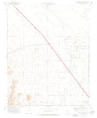
1974 Map of Tule Springs Park
USGS Topo · Published 1977About this map
The Las Vegas Corporate Boundary marks the southern limit of this 1974 topographic survey, revealing a landscape of transition where desert scrub meets the encroaching edges of urban growth. The high desert floor is dominated by the Tule Springs Park and the vast Desert National Wildlife Range to the east. Evidence of the region's industrial and transportation history is etched into the terrain through an Old Railroad Grade and numerous Gravel Pits. A web of Jeep Trails and scattered Prospects suggest a legacy of mineral exploration and rugged recreation northwest of the growing city. The presence of several Wells underscores the critical importance of water management in this arid environment before the full-scale development of the Las Vegas valley reached these northern reaches.
Find a feature on this map
13 named features on this map. Tap any name to fly to it.
Don’t see what you’re looking for? This feature index may not catch every label — zoom into the map to look around manually.
Map Details
Editions of this 1974 Tule Springs Park Map
Other maps of this area

1907 · Las Vegas
USGS Topo · 1:250,000

1908 · Las Vegas
USGS Topo · 1:250,000

1952 · Corn Creek Springs
USGS Topo · 1:62,500

1952 · Gass Peak
USGS Topo · 1:62,500

1952 · Blue Diamond
USGS Topo · 1:62,500

1952 · Las Vegas
USGS Topo · 1:62,500

1954 · Las Vegas
USGS Topo · 1:250,000

1957 · Las Vegas
USGS Topo · 1:250,000

1959 · Las Vegas
USGS Topo · 1:250,000

1962 · Las Vegas
USGS Topo · 1:250,000