
1915 Map of Tule Valley
USGS Topo · Published 1915About this map
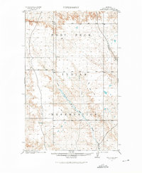
The Fort Peck Indian Reservation dominates this 1909–1910 survey of Sheridan County, revealing a landscape defined by its vital water sources and drainage systems before the mid-century developments in the region. The central topographical feature is the Tule Valley, carved by the winding course of Tule Creek and its tributary, the North Fork Tule Creek. These intermittent waterways, along with scattered features like a lone Spring, were essential landmarks for early 20th-century life on the high plains of northeastern Montana. The map illustrates the transition from the upland divides near Boxelder Creek to the deep, complex coulees that feed into the main valley, providing a clear picture of the land as it was managed by the General Land Office during this era of early settlement and reservation history.
Find a feature on this map
7 named features on this map. Tap any name to fly to it.
Don’t see what you’re looking for? This feature index may not catch every label — zoom into the map to look around manually.
Map Details
Editions of this 1915 Tule Valley Map
2 editions found
Other maps of this area

1910 · Todd Lakes
USGS Topo · 1:62,500

1910 · Cuskers
USGS Topo · 1:62,500

1912 · Chelsea
USGS Topo · 1:62,500

1915 · Oswego
USGS Topo · 1:62,500

1915 · Cuskers
USGS Topo · 1:62,500

1915 · Todd Lakes
USGS Topo · 1:62,500

1916 · Wolf Point
USGS Topo · 1:62,500

1954 · Wolf Point
USGS Topo · 1:250,000

1958 · Wolf Point
USGS Topo · 1:250,000

1972 · Flynn Creek North
USGS Topo · 1:24,000