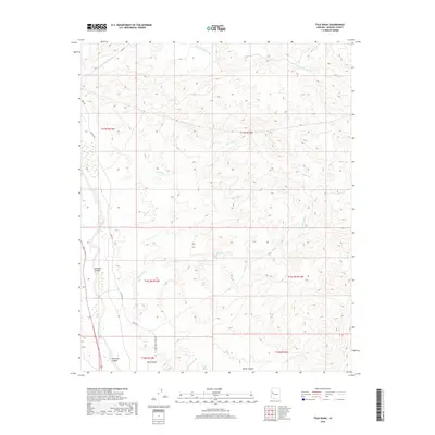
2018 Map of Tule Wash
USGS Topo · Published 2018About this map
The Big Sandy River forms a critical western corridor through this Mohave County landscape, where deep drainage systems like Gunsight Canyon and Tompkins Canyon carve through the arid terrain. The map reveals an intricate network of seasonal watercourses, notably Tule Wash and Pearson Falls Wash, which underscore the desert's complex hydrology. Human infrastructure is limited to a few arterial routes, including Co Hwy 159 and the aptly named Back Rd, reflecting the sparse, utilitarian nature of transit in this part of Arizona. In the southern reaches, topographical names such as Bull Canyon and Boner Canyon hint at the local nomenclature of the backcountry, while the presence of Lower Trout Creek Rd indicates the primary access points for those traversing the rugged margins of the river valley.
Find a feature on this map
19 named features on this map. Tap any name to fly to it.
Don’t see what you’re looking for? This feature index may not catch every label — zoom into the map to look around manually.
Map Details
Editions of this 2018 Tule Wash Map
This is the sole edition of this map. No revisions or reprints were ever made.
Other maps of this area

1923 · Signal
USGS Topo · 1:250,000

1942 · Signal
USGS Topo · 1:250,000

1950 · Prescott
USGS Topo · 1:250,000

1954 · Prescott
USGS Topo · 1:250,000

1958 · Prescott
USGS Topo · 1:250,000

1959 · Prescott
USGS Topo · 1:250,000

1960 · Prescott
USGS Topo · 1:250,000

1965 · Prescott
USGS Topo · 1:250,000
1967 · Gunsight Canyon
USGS Topo · 1:24,000
1967 · Pilgrim Wash
USGS Topo · 1:24,000