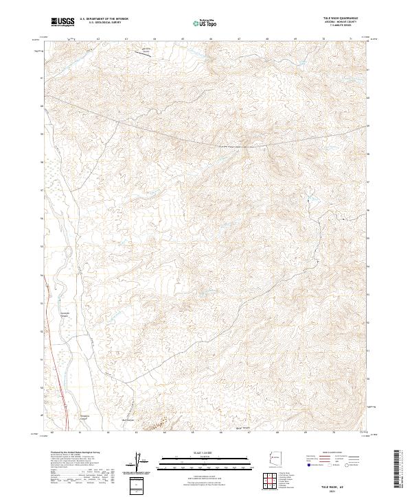
2021 Map of Tule Wash
USGS Topo · Published 2021About this map
Big Sandy River cuts through this arid reach of Mohave County, where the landscape is defined by a dense network of seasonal drainages and steep-walled canyons. The topography is dominated by the erosive power of Tule Wash and Burro Wash, which carve through the high desert terrain toward the river valley. The infrastructure here is sparse, characterized by remote corridors like Co Hwy 159 and the aptly named Back Rd, which provide access to the isolated Big Sandy Airport.
Find a feature on this map
20 named features on this map. Tap any name to fly to it.
Don’t see what you’re looking for? This feature index may not catch every label — zoom into the map to look around manually.
Map Details
Editions of this 2021 Tule Wash Map
This is the sole edition of this map. No revisions or reprints were ever made.
Other maps of this area

1923 · Signal
USGS Topo · 1:250,000

1942 · Signal
USGS Topo · 1:250,000

1950 · Prescott
USGS Topo · 1:250,000

1954 · Prescott
USGS Topo · 1:250,000

1958 · Prescott
USGS Topo · 1:250,000

1959 · Prescott
USGS Topo · 1:250,000

1960 · Prescott
USGS Topo · 1:250,000

1965 · Prescott
USGS Topo · 1:250,000
1967 · Gunsight Canyon
USGS Topo · 1:24,000
1967 · Pilgrim Wash
USGS Topo · 1:24,000