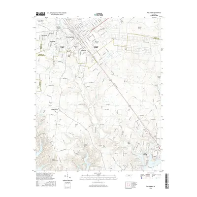
2016 Map of Tullahoma
USGS Topo · Published 2016About this map
Tullahoma serves as the central hub of this 2016 survey, showcasing a dense network of residential developments like Westwood, Bel-Aire, and Plainview Heights alongside the Tullahoma Regional Airport/Wm Northern Field. The landscape transition to the south is defined by the winding waters of Tims Ford Lake and the settlement of Estill Springs. This area is particularly dense with small family and community burial grounds, such as Maplewood Cem, Evergreen Cem, and the Camp Forrest Cem, which reflect the region's deep local history and the footprint of former military installations.
Find a feature on this map
226 named features on this map. Tap any name to fly to it.
Don’t see what you’re looking for? This feature index may not catch every label — zoom into the map to look around manually.
Map Details
Editions of this 2016 Tullahoma Map
This is the sole edition of this map. No revisions or reprints were ever made.
Other maps of this area

1928 · Decherd
USGS Topo · 1:62,500

1936 · Ovoca
USGS Topo · 1:24,000

1936 · Manchester
USGS Topo · 1:24,000

1936 · Cumberland Springs
USGS Topo · 1:24,000

1936 · Winchester
USGS Topo · 1:24,000

1936 · Belvidere
USGS Topo · 1:24,000

1936 · Camp Peay
USGS Topo · 1:24,000

1936 · Capitol Hill
USGS Topo · 1:24,000

1936 · Normandy
USGS Topo · 1:24,000

1936 · Lois
USGS Topo · 1:24,000