2022 Map of Tullahoma
USGS Topo · Published 2022About this map
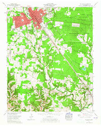
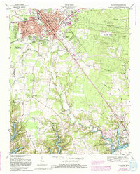
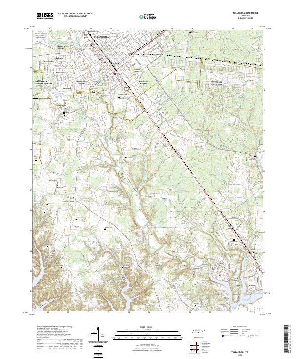
Tullahoma serves as the centerpiece of this Coffee County survey, showcasing a dense network of neighborhoods including Johnstown, Plainview Heights, and Westside Heights. The map documents a complex landscape of memory and infrastructure, from the large Tullahoma Regional Airport/William Northern Field to numerous family burial grounds such as the Holt Family Cem and Lasater Cem. The geography is defined by the convergence of several waterways, including Rock Cr and N Fork Blue Cr, which carve through the terrain toward the southern reaches of the quadrangle.
Find a feature on this map
243 named features on this map. Tap any name to fly to it.
Don’t see what you’re looking for? This feature index may not catch every label — zoom into the map to look around manually.
Map Details
Editions of this 2022 Tullahoma Map
This is the sole edition of this map. No revisions or reprints were ever made.
Historical Maps of Oak Park Through Time
4 maps found