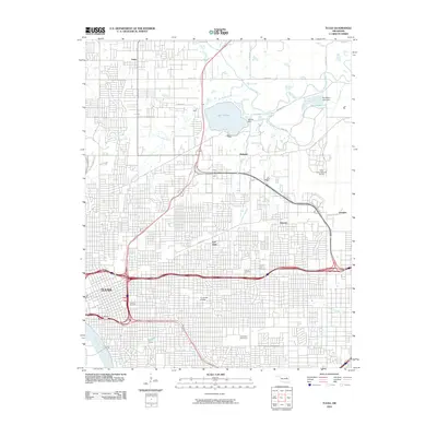
2010 Map of Tulsa
USGS Topo · Published 2010About this map
The Arkansas River defines the southwestern corner of this urban and suburban landscape, anchoring the bustling city of Tulsa as it expands northward and eastward. This survey captures the dense residential and industrial grid that characterizes communities like East Tulsa, Dawson, and Mohawk. A significant portion of the northern area is dedicated to infrastructure and public works, dominated by the Tulsa International Airport and the waters of Lake Yahola, which is secured by the Yahola Dam.
Find a feature on this map
32 named features on this map. Tap any name to fly to it.
Don’t see what you’re looking for? This feature index may not catch every label — zoom into the map to look around manually.
Map Details
Editions of this 2010 Tulsa Map
This is the sole edition of this map. No revisions or reprints were ever made.
Other maps of this area

1901 · Claremore
USGS Topo · 1:125,000

1912 · Hominy
USGS Topo · 1:125,000

1914 · Claremore
USGS Topo · 1:125,000

1915 · Hominy
USGS Topo · 1:125,000

1916 · Claremore
USGS Topo · 1:125,000

1952 · Jenks
USGS Topo · 1:24,000

1954 · Tulsa
USGS Topo · 1:250,000

1954 · Tulsa
USGS Topo · 1:24,000

1955 · Sperry
USGS Topo · 1:24,000

1955 · Mingo
USGS Topo · 1:24,000