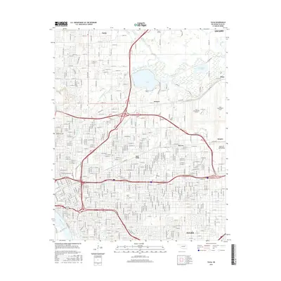
2016 Map of Tulsa
USGS Topo · Published 2016About this map
The Arkansas River defines the southwestern edge of this 2016 survey, a period when the city's growth is reflected in its dense grid and established institutions. The campus of the Univ of Tulsa and the Spartan Coll of Aeronautics and Technology anchor the educational landscape, while legacy locations like Swan Lake and Rose Hill Cem provide historical continuity. To the north and east, the character of the terrain shifts toward the water systems of Bird Creek, Lake Yahola, and Recreation Lake.
Find a feature on this map
127 named features on this map. Tap any name to fly to it.
Don’t see what you’re looking for? This feature index may not catch every label — zoom into the map to look around manually.
Map Details
Editions of this 2016 Tulsa Map
This is the sole edition of this map. No revisions or reprints were ever made.
Other maps of this area

1901 · Claremore
USGS Topo · 1:125,000

1912 · Hominy
USGS Topo · 1:125,000

1914 · Claremore
USGS Topo · 1:125,000

1915 · Hominy
USGS Topo · 1:125,000

1916 · Claremore
USGS Topo · 1:125,000

1952 · Jenks
USGS Topo · 1:24,000

1954 · Tulsa
USGS Topo · 1:250,000

1954 · Tulsa
USGS Topo · 1:24,000

1955 · Sperry
USGS Topo · 1:24,000

1955 · Mingo
USGS Topo · 1:24,000