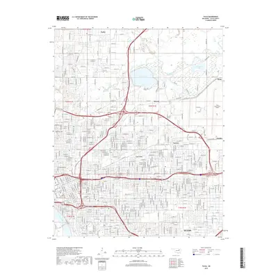
2019 Map of Tulsa
USGS Topo · Published 2019About this map
The Arkansas River winds along the southwestern edge of this 2019 urban landscape, anchoring a dense grid that expands into established neighborhoods and industrial sectors. Central to the map is the historic Oaklawn Cem, located near the heart of Tulsa, while further northeast the Rose Hill Cem sits near the community of Dawson. The geography is defined by a series of waterways, including Bird Creek and Flat Rock Cr that feed into Lake Yahola and the nearby Recreation Lake. This era shows a fully integrated infrastructure where the Gilcrease Expy and Mohawk Blvd navigate between older residential districts like Turley and the significant footprint of the Tulsa International Airport. The presence of small inner-city landmarks like Swan Lake contrasts with the massive drainage systems of Coal Cr and Mill Cr, illustrating the city's complex relationship with its river-basin topography.
Find a feature on this map
29 named features on this map. Tap any name to fly to it.
Don’t see what you’re looking for? This feature index may not catch every label — zoom into the map to look around manually.
Map Details
Editions of this 2019 Tulsa Map
This is the sole edition of this map. No revisions or reprints were ever made.
Other maps of this area

1901 · Claremore
USGS Topo · 1:125,000

1912 · Hominy
USGS Topo · 1:125,000

1914 · Claremore
USGS Topo · 1:125,000

1915 · Hominy
USGS Topo · 1:125,000

1916 · Claremore
USGS Topo · 1:125,000

1952 · Jenks
USGS Topo · 1:24,000

1954 · Tulsa
USGS Topo · 1:250,000

1954 · Tulsa
USGS Topo · 1:24,000

1955 · Sperry
USGS Topo · 1:24,000

1955 · Mingo
USGS Topo · 1:24,000