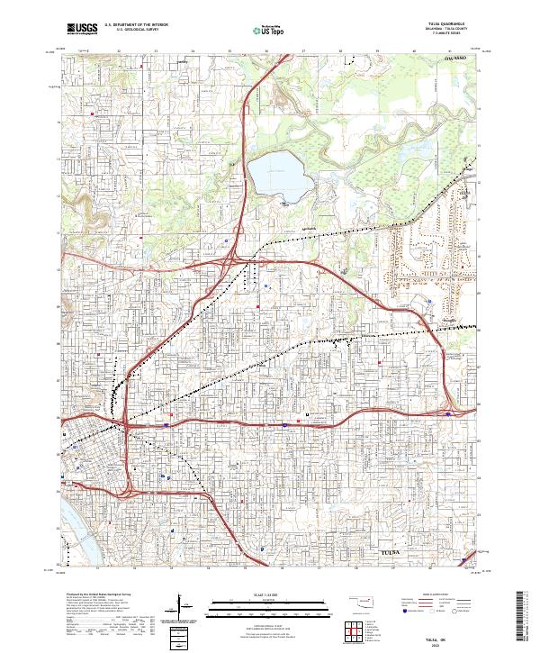
2022 Map of Tulsa
USGS Topo · Published 2022About this map
The Arkansas River and its northern tributaries anchor the urban landscape of Tulsa in this contemporary 2022 survey. This map documents a dense educational and industrial corridor, featuring the University of Tulsa, Oklahoma State University - Tulsa, and the Spartan College of Aeronautics and Technology. To the north, the sprawling greenspace of Mohawk Park surrounds Lake Yahola and Recreation Lake, providing a contrast to the grid of the city. Older neighborhood identities are preserved through labels like Dawson, Mohawk, and Turley, while the BNSF Railway continues its path through the heart of the metro. For genealogists and local historians, Rose Hill Cem is a significant landmark on the eastern side. The map also captures the topography of Reservoir Hill and the residential character surrounding Swan Lake, illustrating the intersection of natural hydrology and a modern Oklahoma metropolitan hub.
Find a feature on this map
133 named features on this map. Tap any name to fly to it.
Don’t see what you’re looking for? This feature index may not catch every label — zoom into the map to look around manually.
Map Details
Editions of this 2022 Tulsa Map
This is the sole edition of this map. No revisions or reprints were ever made.
Other maps of this area

1901 · Claremore
USGS Topo · 1:125,000

1912 · Hominy
USGS Topo · 1:125,000

1914 · Claremore
USGS Topo · 1:125,000

1915 · Hominy
USGS Topo · 1:125,000

1916 · Claremore
USGS Topo · 1:125,000

1952 · Jenks
USGS Topo · 1:24,000

1954 · Tulsa
USGS Topo · 1:250,000

1954 · Tulsa
USGS Topo · 1:24,000

1955 · Sperry
USGS Topo · 1:24,000

1955 · Mingo
USGS Topo · 1:24,000