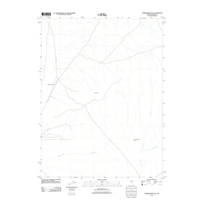
2012 Map of Tumbleweed Flat
USGS Topo · Published 2012About this map
Crescent Valley and the Dry Hills dominate this portion of Eureka County, Nevada, where the drainage patterns of the high desert define the landscape. The seasonal waters of Thomas Creek, Neil Creek, and Sod House Creek feed toward the expansive Tumbleweed Flat in the southeast. This 2012 survey illustrates the sparse infrastructure characteristic of the Great Basin, with primitive routes such as SFA to Dry Hills Rd and Gold Spring Pt providing the only primary access points through the basin and range terrain. The map captures the intersection of topography and hydrology in an area where water flow dictates the location of early roads and land use.
Find a feature on this map
8 named features on this map. Tap any name to fly to it.
Don’t see what you’re looking for? This feature index may not catch every label — zoom into the map to look around manually.
Map Details
Editions of this 2012 Tumbleweed Flat Map
This is the sole edition of this map. No revisions or reprints were ever made.
Other maps of this area

1949 · Crescent Valley
USGS Topo · 1:62,500

1950 · Crescent Valley
USGS Topo · 1:62,500

1955 · Winnemucca
USGS Topo · 1:250,000

1957 · Frenchie Creek
USGS Topo · 1:62,500

1957 · Dunphy
USGS Topo · 1:62,500

1957 · Beowawe
USGS Topo · 1:62,500

1958 · Winnemucca
USGS Topo · 1:250,000

1962 · Winnemucca
USGS Topo · 1:250,000
1985 · Thatcher Spring
USGS Topo · 1:24,000
1985 · Hand-Me-Down Creek
USGS Topo · 1:24,000