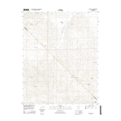
2015 Map of Tumey Hills
USGS Topo · Published 2015About this map
The Diablo Range defines the stark topography of this 2015 survey, where the Panoche Hills and Tumey Hills meet the western edge of the San Joaquin Valley. This landscape is primarily characterized by its dramatic drainage systems and ridge lines, including Right Angle Canyon and the winding course of Panoche Cr. A significant cultural boundary is marked by the line dividing Fresno Co and San Benito Co, which cuts diagonally across the high country through the Griswold Hills. Transport through these arid uplands is limited to established routes like Panoche Rd and the evocatively named Valley Desertion Rd. The map illustrates the sharp transition where the steep, creek-carved terrain of the Ciervo Hills suddenly flattens into the productive expanse of the Central Valley.
Find a feature on this map
18 named features on this map. Tap any name to fly to it.
Don’t see what you’re looking for? This feature index may not catch every label — zoom into the map to look around manually.
Map Details
Editions of this 2015 Tumey Hills Map
This is the sole edition of this map. No revisions or reprints were ever made.
Other maps of this area

1913 · Panoche
USGS Topo · 1:125,000

1915 · Priest Valley
USGS Topo · 1:125,000

1921 · Tierra Loma School
USGS Topo · 1:31,680

1922 · Chaney Ranch
USGS Topo · 1:31,680

1923 · Tierra Loma School
USGS Topo · 1:31,680

1923 · Monocline Ridge
USGS Topo · 1:31,680

1943 · New Idria
USGS Topo · 1:62,500

1943 · Hernandez Valley
USGS Topo · 1:62,500

1944 · Hernandez Valley
USGS Topo · 1:62,500

1944 · Panoche Valley
USGS Topo · 1:62,500