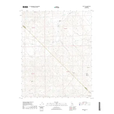
2018 Map of Tumey Hills
USGS Topo · Published 2018About this map
The Tumey Hills and Griswold Hills define this high-relief landscape along the border of Fresno and San Benito counties. This 2018 survey illustrates the complex topography where the Diablo Range meets the western edge of the San Joaquin Valley. Major drainage systems like Silver Cr and Panoche Cr carve through the arid terrain, creating prominent features such as Right Angle Canyon and Tumey Gulch. The road network is sparse, centered primarily on Panoche Rd which provides access through the northern reaches of the quadrangle. Southward, the map transitions into the Ciervo Hills, showing a vast area of undeveloped land and public land survey boundaries that remain largely untouched by modern urbanization.
Find a feature on this map
16 named features on this map. Tap any name to fly to it.
Don’t see what you’re looking for? This feature index may not catch every label — zoom into the map to look around manually.
Map Details
Editions of this 2018 Tumey Hills Map
This is the sole edition of this map. No revisions or reprints were ever made.
Other maps of this area

1913 · Panoche
USGS Topo · 1:125,000

1915 · Priest Valley
USGS Topo · 1:125,000

1921 · Tierra Loma School
USGS Topo · 1:31,680

1922 · Chaney Ranch
USGS Topo · 1:31,680

1923 · Tierra Loma School
USGS Topo · 1:31,680

1923 · Monocline Ridge
USGS Topo · 1:31,680

1943 · New Idria
USGS Topo · 1:62,500

1943 · Hernandez Valley
USGS Topo · 1:62,500

1944 · Hernandez Valley
USGS Topo · 1:62,500

1944 · Panoche Valley
USGS Topo · 1:62,500