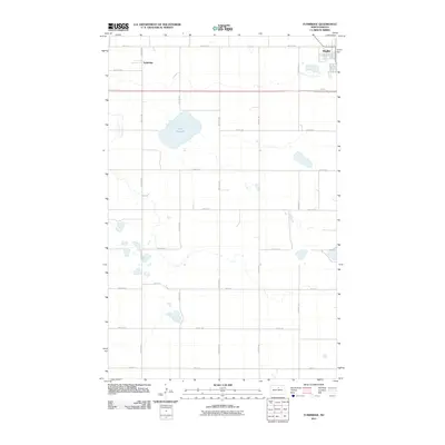
2011 Map of Tunbridge
USGS Topo · Published 2011About this map
The settlement of Tunbridge sits at the northern end of this central North Dakota landscape, situated along a section of the Great Northern railway corridor. To the east, the edge of Rugby marks the regional hub, known as the geographic center of North America. The terrain is characterized by the expansive wetland of Sand Slough, a prominent water feature that breaks the regular grid of agricultural sections. The map traces a network of rural section lines, including 24th Ave NE and 66th St NE, which define the local transport pattern between fields and farmsteads. Modern transit is anchored by Hwy 2 W, which cuts horizontally across the sheet, mirroring the older rail alignment and connecting the small community of Tunbridge with the growing outskirts of Rugby.
Find a feature on this map
19 named features on this map. Tap any name to fly to it.
Don’t see what you’re looking for? This feature index may not catch every label — zoom into the map to look around manually.
Map Details
Editions of this 2011 Tunbridge Map
This is the sole edition of this map. No revisions or reprints were ever made.
Other maps of this area

1953 · Devils Lake
USGS Topo · 1:250,000

1954 · Tunbridge
USGS Topo · 1:24,000

1954 · Berwick
USGS Topo · 1:24,000

1954 · Round Lake
USGS Topo · 1:24,000

1954 · Rugby NW
USGS Topo · 1:24,000

1954 · Leverich
USGS Topo · 1:24,000

1954 · Minot
USGS Topo · 1:250,000

1955 · Rugby
USGS Topo · 1:24,000

1956 · Devils Lake
USGS Topo · 1:250,000

1958 · Minot
USGS Topo · 1:250,000