
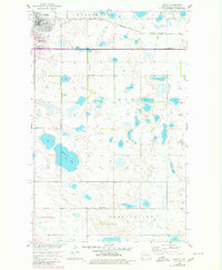
1955 Map of Rugby
USGS Topo · Published 1956About this map
Rugby serves as the focal point of this 1950s survey, famously home to the Geographical Center of North America Monument. The town's grid is defined by the Great Northern railroad, which cuts through the northern landscape of Torgerson and Meyer townships. This map captures a rural educational system in transition, documenting active sites like School No 1 alongside several shuttered facilities, including Lincoln Sch No 2 (Abandoned) and Lincoln Sch No 3 (Abandoned). Outside the town limits, the terrain is dotted with numerous small wetlands and larger bodies like Gunderson Lake, reflecting the prairie pothole landscape of Pierce County. The presence of Little Flower Cem and multiple local schools across Tuscarora and Reno Valley provides essential landmarks for genealogists tracing early twentieth-century families in this agricultural region.
Find a feature on this map
17 named features on this map. Tap any name to fly to it.
Don’t see what you’re looking for? This feature index may not catch every label — zoom into the map to look around manually.
Map Details
Editions of this 1955 Rugby Map
2 editions found
Other maps of this area

1953 · Devils Lake
USGS Topo · 1:250,000

1954 · Tunbridge
USGS Topo · 1:24,000

1954 · Rugby NW
USGS Topo · 1:24,000

1954 · Leverich
USGS Topo · 1:24,000

1954 · Minot
USGS Topo · 1:250,000

1956 · Devils Lake
USGS Topo · 1:250,000

1958 · Minot
USGS Topo · 1:250,000

1958 · Fillmore
USGS Topo · 1:24,000

1958 · Balta
USGS Topo · 1:24,000
1958 · Silva
USGS Topo · 1:24,000