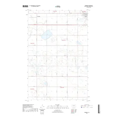
2017 Map of Tunbridge
USGS Topo · Published 2017About this map
The settlement of Tunbridge and the southwestern edge of Rugby anchor this landscape in Pierce County, revealing the rigid, rectilinear grid of the prairie north of the geographical center of North America. The terrain is defined by a dense network of sectional roads, including 66th St NE and 24th Ave Ne, which carve the landscape into distinct agricultural blocks. A significant hydrologic feature, Sand Slough, occupies the northern central portion of the quadrangle, surrounded by numerous unnamed wetlands and ephemeral ponds that reflect the glaciated pothole geology of the region. This 2017 survey demonstrates how the township and range system, marked here by boundaries like t156n r73w, continues to dictate the human footprint on the land, with scattered homesteads and farmsteads positioned along the intersections of these gravel and dirt corridors.
Find a feature on this map
28 named features on this map. Tap any name to fly to it.
Don’t see what you’re looking for? This feature index may not catch every label — zoom into the map to look around manually.
Map Details
Editions of this 2017 Tunbridge Map
This is the sole edition of this map. No revisions or reprints were ever made.
Other maps of this area

1953 · Devils Lake
USGS Topo · 1:250,000

1954 · Tunbridge
USGS Topo · 1:24,000

1954 · Berwick
USGS Topo · 1:24,000

1954 · Round Lake
USGS Topo · 1:24,000

1954 · Rugby NW
USGS Topo · 1:24,000

1954 · Leverich
USGS Topo · 1:24,000

1954 · Minot
USGS Topo · 1:250,000

1955 · Rugby
USGS Topo · 1:24,000

1956 · Devils Lake
USGS Topo · 1:250,000

1958 · Minot
USGS Topo · 1:250,000