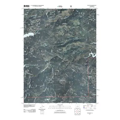
2011 Map of Tungsten
USGS Topo · Published 2011About this map
Tungsten (historical) serves as the namesake for this landscape defined by a high concentration of hard-rock mining operations. The density of mining claims near Hurricane Hill and Tungsten Mountain is exceptional, including the Crucible Steel Mine, Vasco Number Seven Mine, and the Nancy Henderson Mine. This mineral wealth supported a network of small settlements and camps throughout the rugged drainages of Middle Boulder Creek and South Boulder Creek, where community life was anchored in places like Rollinsville and Pinecliffe.
Find a feature on this map
134 named features on this map. Tap any name to fly to it.
Don’t see what you’re looking for? This feature index may not catch every label — zoom into the map to look around manually.
Map Details
Editions of this 2011 Tungsten Map
This is the sole edition of this map. No revisions or reprints were ever made.
Other maps of this area

1899 · West Denver
USGS Topo · 1:125,000

1902 · Boulder
USGS Topo · 1:62,500

1904 · Boulder
USGS Topo · 1:62,500

1905 · Central City
USGS Topo · 1:62,500

1906 · Blackhawk
USGS Topo · 1:62,500

1910 · Central City
USGS Topo · 1:62,500

1912 · Central City
USGS Topo · 1:62,500

1915 · Longs Peak
USGS Topo · 1:125,000

1919 · Rocky Mountain National Park
USGS Topo · 1:125,000

1942 · Eldorado Springs
USGS Topo · 1:24,000