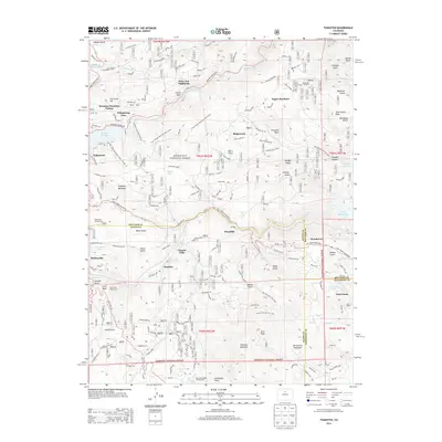
2013 Map of Tungsten
USGS Topo · Published 2013About this map
Nederland and the surrounding high country of the Roosevelt National Forest define this landscape along the eastern edge of the Continental Divide. The town sits at the western edge of Barker Reservoir, a central water feature alongside the massive Gross Reservoir further east. This 2013 survey shows a region where modern mountain residential enclaves like Saint Ann Highlands and Aspen Meadows are built into a terrain shaped by historical mining and scientific utility, represented by Tungsten Mountain and the Fritz Peak Observatory. The network of Front Range Mountain Bike Trails and the Peak to Peak Hwy highlight the area's contemporary transition toward recreation. Smaller settlements like Pinecliffe, Pactolus, and Lincoln Hills follow the drainage of S Boulder Cr, marking the enduring importance of river corridors in mountain development.
Find a feature on this map
99 named features on this map. Tap any name to fly to it.
Don’t see what you’re looking for? This feature index may not catch every label — zoom into the map to look around manually.
Map Details
Editions of this 2013 Tungsten Map
This is the sole edition of this map. No revisions or reprints were ever made.
Other maps of this area

1899 · West Denver
USGS Topo · 1:125,000

1902 · Boulder
USGS Topo · 1:62,500

1904 · Boulder
USGS Topo · 1:62,500

1905 · Central City
USGS Topo · 1:62,500

1906 · Blackhawk
USGS Topo · 1:62,500

1910 · Central City
USGS Topo · 1:62,500

1912 · Central City
USGS Topo · 1:62,500

1915 · Longs Peak
USGS Topo · 1:125,000

1919 · Rocky Mountain National Park
USGS Topo · 1:125,000

1942 · Eldorado Springs
USGS Topo · 1:24,000