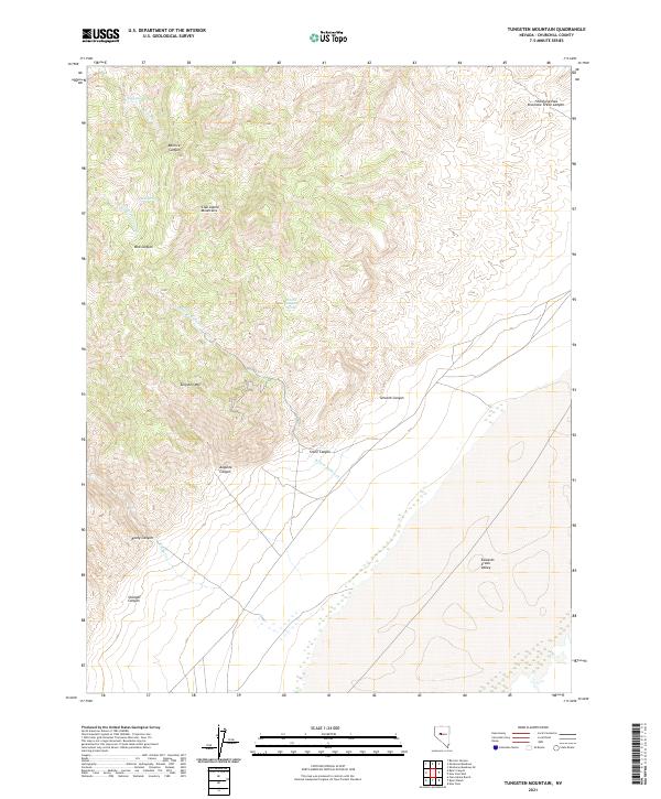
2021 Map of Tungsten Mountain
USGS Topo · Published 2021About this map
Tungsten Mtn stands as a central landmark in this high-elevation corridor of the Clan Alpine Mountains. The landscape is defined by a series of deep drainages, including Bernice Canyon and Bob Canyon, which funnel seasonal water from higher peaks toward the Edwards Creek Valley to the east. Historically, these canyons and springs were vital in an arid region, evidenced by the presence of Eagle Springs, Bob Spring, and Smooth Canyon Spring. The terrain here is marked by significant topographic relief, where routes like Shoshone Pass provided natural passage through the Shoshone Creek Canyon. The naming of the peak itself points to the region's mineral interests, while the surrounding canyons like Straight Canyon and Stone Canyon illustrate the complex geological erosion of the Great Basin range.
Find a feature on this map
25 named features on this map. Tap any name to fly to it.
Don’t see what you’re looking for? This feature index may not catch every label — zoom into the map to look around manually.
Map Details
Editions of this 2021 Tungsten Mountain Map
This is the sole edition of this map. No revisions or reprints were ever made.
Other maps of this area

1955 · Millett
USGS Topo · 1:250,000

1959 · Millett
USGS Topo · 1:250,000

1966 · Clan Alpine Ranch
USGS Topo · 1:62,500

1966 · Humboldt Salt Marsh
USGS Topo · 1:62,500

1966 · Shoshone Meadows
USGS Topo · 1:62,500

1966 · Edwards Creek Valley
USGS Topo · 1:62,500

1983 · Edwards Creek Valley
USGS Topo · 1:100,000

1990 · Byers Ranch
USGS Topo · 1:24,000
1990 · Bernice Canyon
USGS Topo · 1:24,000
1990 · Byers Canyon
USGS Topo · 1:24,000