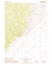
1990 Map of Tungsten Mtn.
USGS Topo · Published 1990About this map
Tungsten Mtn Mine sits at the heart of this high-desert landscape, anchored by the namesake Tungsten Mtn within the Clan Alpine Mountains. This 1990 provisional map documents the rugged topography of Churchill County, where steep drainage systems like Bernice Canyon and Augusta Canyon descend toward the broad Edwards Creek Valley. The terrain is defined by a series of springs and seasonal water sources, such as Bob Spring and Smooth Canyon Spring, which were vital for mining operations and transit through the arid corridor. To the east, the valley floor transitions into a large Dry Lake bed, marked by a distinct Shoreline that traces the ancient margins of the basin. The presence of Shoshone Pass in the northeast suggests historical movement through the range, connecting the interior canyons to the surrounding flats.
Find a feature on this map
18 named features on this map. Tap any name to fly to it.
Don’t see what you’re looking for? This feature index may not catch every label — zoom into the map to look around manually.
Map Details
Editions of this 1990 Tungsten Mtn. Map
This is the sole edition of this map. No revisions or reprints were ever made.
Other maps of this area

1955 · Millett
USGS Topo · 1:250,000

1959 · Millett
USGS Topo · 1:250,000

1966 · Clan Alpine Ranch
USGS Topo · 1:62,500

1966 · Humboldt Salt Marsh
USGS Topo · 1:62,500

1966 · Shoshone Meadows
USGS Topo · 1:62,500

1966 · Edwards Creek Valley
USGS Topo · 1:62,500

1983 · Edwards Creek Valley
USGS Topo · 1:100,000

1990 · Byers Ranch
USGS Topo · 1:24,000
1990 · Bernice Canyon
USGS Topo · 1:24,000
1990 · Byers Canyon
USGS Topo · 1:24,000